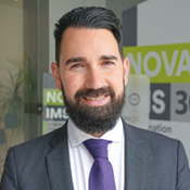
Biography
With more than 17 years of experience in Information Systems and Digital Innovation, he is currently the Chief Information Officer (CIO) at NOVA Information Management School (NOVA IMS), where he is responsible for driving the institution’s Digital Transformation. In this role, he designed and implemented an integrated learning analytics ecosystem, a pioneering initiative in Portuguese higher education that enables real-time academic management and supports data-driven decision-making.
Recognized for his strategic vision in digital transformation, he received, both in 2024, the Portugal Digital Award in the category Best Education Project by IDC Portugal, and the ADN Award from Universidade NOVA de Lisboa in Digital Transformation and Organizational Innovation.
Throughout his career, he has coordinated around 85 national and international R&D projects, maintaining strong ties between academia and both the public and private sectors. He is also Coordinator of the Master’s in Geographic Information Systems and Science at NOVA IMS and served as Coordinator of the UNIGIS International Association, one of the leading international networks in Geographic Information Systems education.
He has over 15 years of teaching experience in higher education and is currently an Adjunct Lecturer for the courses Social Network Intelligence (Postgraduate Program in Information Management and Security) and Geospatial Intelligence (Undergraduate Programs) at NOVA IMS.
He also plays an active role in scientific output, being the author of more than 50 scientific publications, a regular speaker at national and international conferences, and a peer reviewer for scientific journals. He attended the Doctoral Program in Information Management at NOVA IMS, with research entitled “The Emotion-aware City: An Ambient Geographic Information (AGI) approach to understand Emotion within Smart Cities.” He also completed the International Course in ICT Leadership for University CIOs at the University of Murcia, strengthening his executive training in technological leadership.
Beyond the academic and professional spheres, he is a columnist for the Público newspaper (P3 supplement), author of a children’s book, contributor to six poetry anthologies, and a volunteer storyteller at the Nuvem Vitória Association.
