Biography
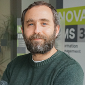
Bachelor's degree in Geographical Engineering from the Faculty of Sciences of Lisbon (1995-2000) and a Master's in Geographic Information Science and Systems from NOVA IMS (2007-2010). From 2001 onwards, Alexandre worked as a Cartographer and GIS Specialist in various national entities, including Turinta, Lda., Cascais Ambiente, and the Directorate-General for Natural Resources, Safety, and Maritime Services. In 2012, he became interested in Open Source and eventually transitioned to working exclusively with Open Source software, becoming an active voice in the Open Source movement. Since then, he has actively participated in the QGIS project. Between 2016 and 2019, Alexandre worked in the development and support team for QGIS at Boundless Spatial in the USA. Since 2019, he has worked as an independent geospatial consultant for several national and international entities. In this role, he performs spatial analysis, develops workflows and tools for QGIS and PostGIS, and provides training in Open Source GIS. This activity includes introductory courses in GIS using QGIS, Advanced Cartography and Data Visualization with QGIS, Relational Databases using PostgreSQL/PostGIS, and QGIS and PostGIS for the preparation of topographic cartography homologation by DGT (RECART).
